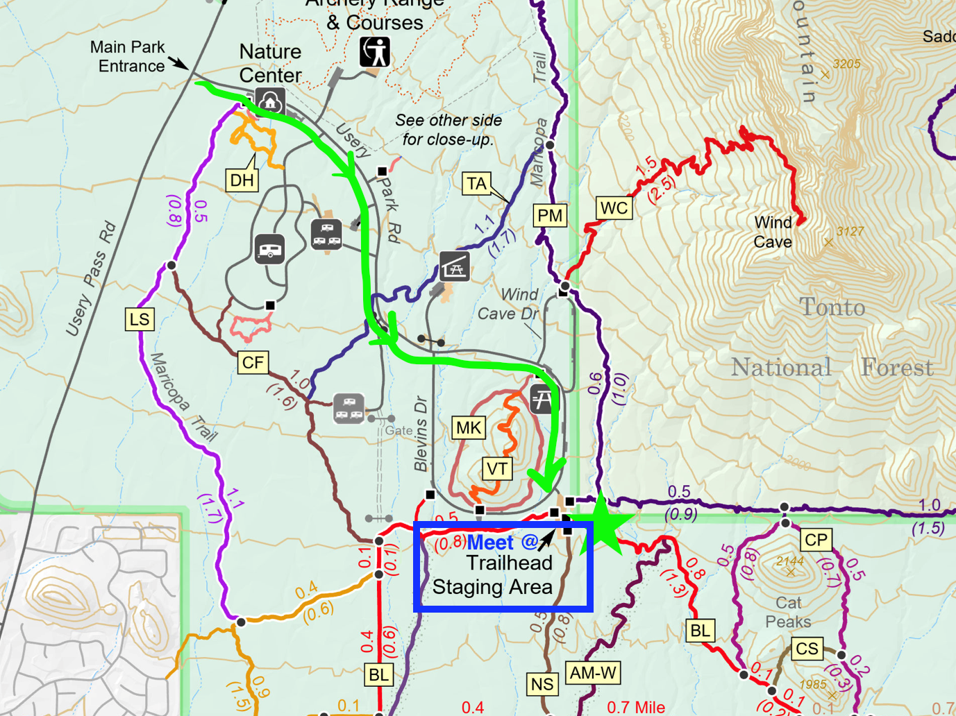
Total distance: 5 miles.
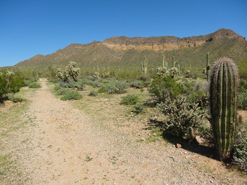
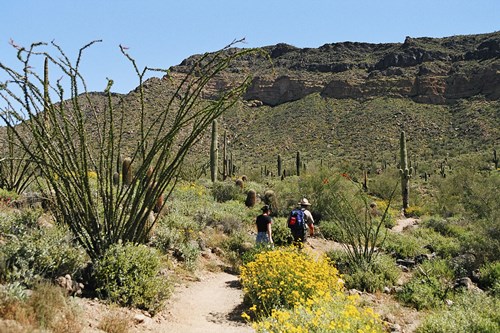
We will be hiking mostly on Blevins Trail which is mostly packed gravel going in and out of a few washes. We will do a counterclockwise loop, with an extension on the East end called Cat Peaks Loop. The trail is rated ‘Easy’ with a short section of ‘Moderate’ on the east side of Cat Peaks. While this is an easy hike, there are several places where someone can head back to the parking lot as desired.
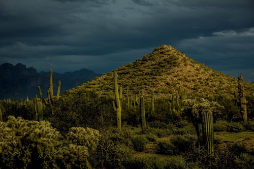
The Usery Mountain Regional Park is set at the western end of the Goldfield Mountains, adjacent to the Tonto National Forest. The park contains a large variety of plants and animals that call the lower Sonoran Desert home. The park is a great training ground for your Camino with Pass Mountain Trail or Wind Cave to add variety and elevation - although along the Camino Frances and Portuguese you won't encounter any of the rock step-ups found on these desert trails.
For park details and maps, see the official website here:
https://www.maricopacountyparks.net/assets/1/6/usery-8x14.pdf
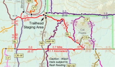
Start at Trailhead staging area.
Go West on Blevins Trail (red track) and loop
counterclockwise.
At East end of loop, branch off on Meridian (brown track), continue for
about 0.1 mile.
Turn left onto Cat Peaks Loop (purple track), follow for
1.2 miles.
NOTE: A $10 vehicle entry fee or Maricopa County Parks pass is required to enter Usery Mountain Regional Park.
A total of 47 people have registered so far. The following 47 have opted to share their information.
No records found.
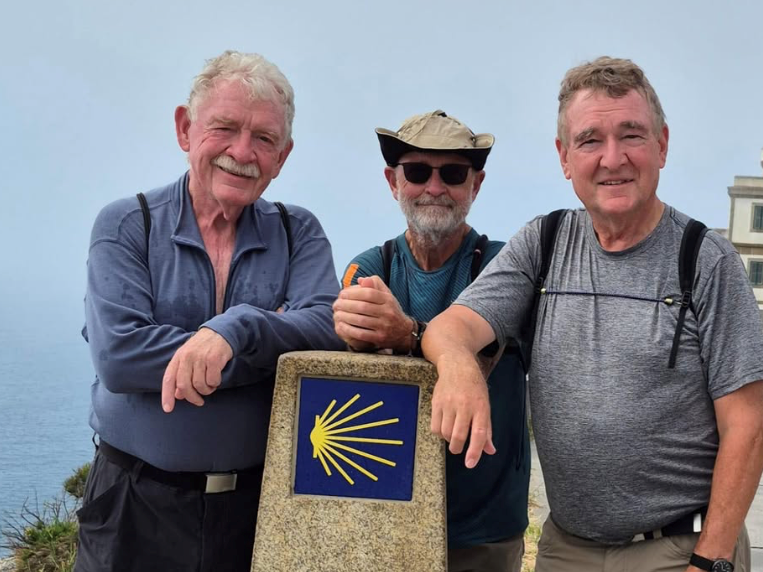
Tom (pictured on left with his brothers) is an experienced pilgrim and a member of the Valley of the Sun Core Team. He has walked the Camino Frances ('15), the Norte/Primitivo ('22) and the Portuguese from Porto ('25) as well as walking to Finisterre and Muxia. He is also known for bringing his delicious Tarta de Santiago (almond cake) to potlucks!
- $10 park entrance fee OR your Maricopa County Park Pass
- Your own map or navigation software of the area
- Water and snacks
- Hat and Sunscreen
- First aid kit
- Poles (optional)
- A leave-no-trace toilet kit
- Cash for donations to support the chapter (optional)
There are water and restrooms at the trailhead.
Please stay home if you are feeling sick.
Call or text your hike leader Tom @ 541-954-3628, or Steven @ 480-465-9732 on the day of the hike if you are unable to make it or are running late.
No dogs allowed due to chapter liability.
We will share the trail with other hikers and mountain bikers so despite our engaging conversations we will be aware of our surroundings and courteous by stepping off the trail or walking single file when necessary.
Reminders: Our chapter activities are led by volunteers. Donativo contributions (cash only) are greatly appreciated and are used to support future activities. Look for the orange donativo jar by the signup at the beginning of each hike.
We always gather in the spirit of the Camino. The hike leader will try to maintain awareness of the pace of the group, and will stop periodically at trail intersections to allow all participants to catch up. However, hikers/walkers are differently abled and may not finish at the same time. If you want to hike ahead or stay behind and leave the group, please notify the hike leader or sweep. Please review the trail description before signing up to be sure the hike is right for you and your abilities. You participate at your own risk.
Visit https://azdot.gov/weekend-freeway-travel-advisory and plan your route and travel time accordingly.
Usery Mountain Regional Park: 3939 N. Usery Pass Rd, Mesa, is in North Mesa (near N. Ellsworth & E. McDowell Roads). Please use your car/phone navigation to find the best route on the day of the hike due to freeway construction.
To Staging Area - Follow Usery Park Road 1.5 miles through a few curves - DO NOT turn on Blevins Drive OR Wind Cave - until you see a LARGE GRAVEL parking area on your left with a space for a large RV and bathrooms.
PAY $10 Vehicle Entry Fee (or show Maricopa County annual pass)
Carpooling recommended, to save gas and fees.