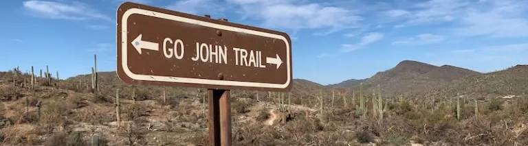
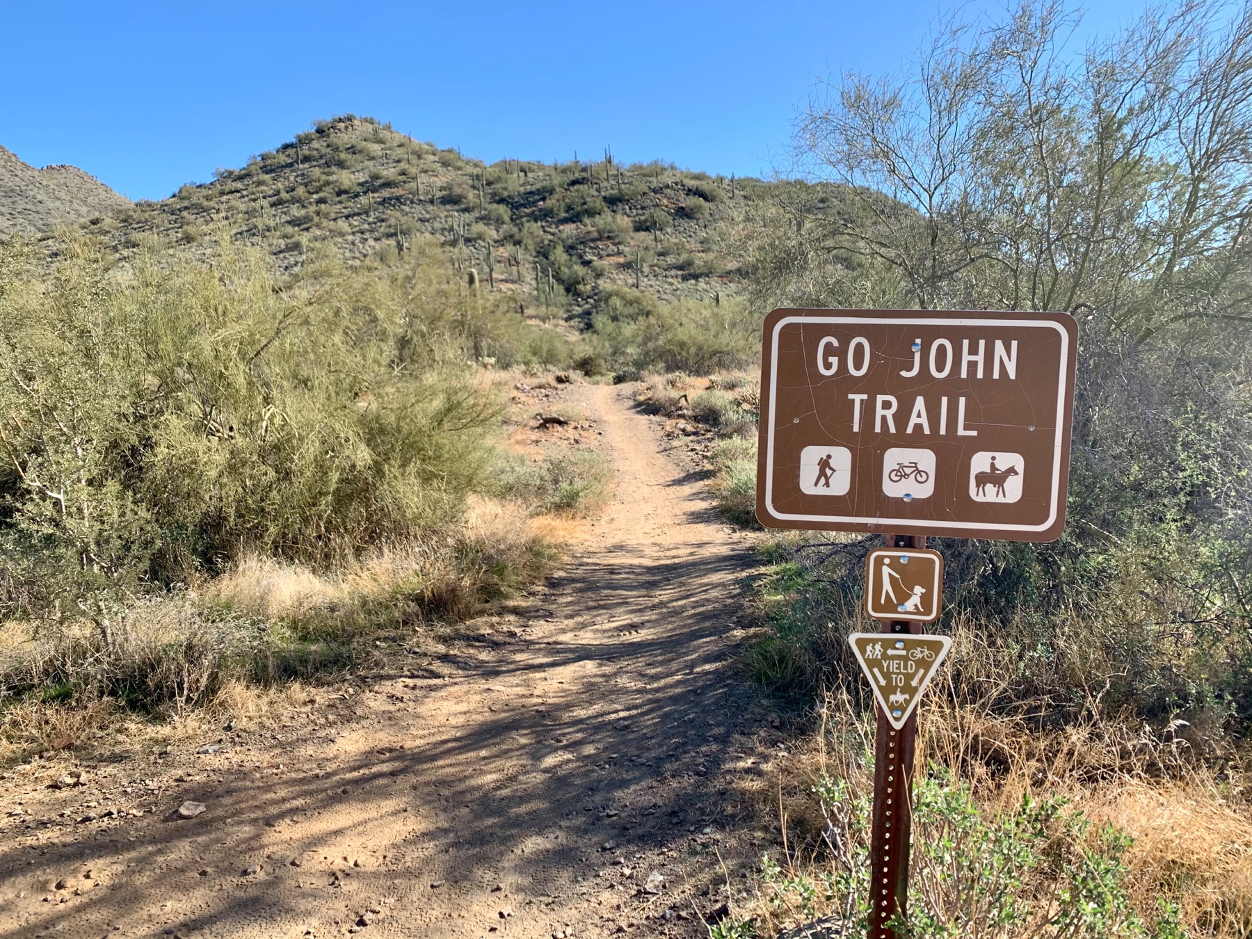
Go John Trail Hike
Moderate hike in the Upper Sonoran Desert
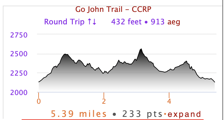
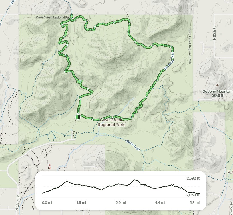
Total distance: 5.8 miles
Elevation: ~411 ft
Meet at 6:45 am @ Go John Trailhead Parking for departure @ 7:00 am
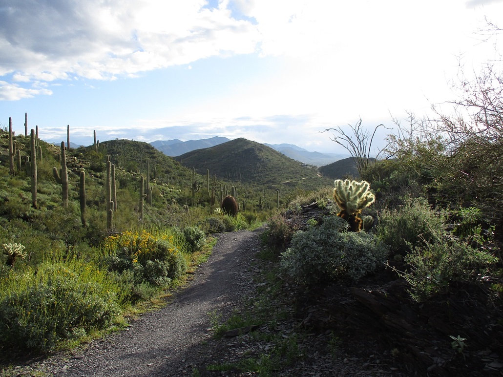
Cave Creek Regional Park is
located north of Phoenix, and became part of Maricopa County's regional
park system in 1963. This 2,922-acre
park sits in the upper Sonoran Desert and ranges in elevation from 2,000 feet
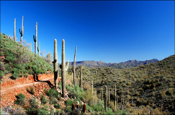
to 3,060 feet. This desert oasis provides any hiker and equestrian majestic
views. The Go John Trail loops around a mountain to provide the illusion of
being miles away from civilization. The loop is 5.8 miles long, with a total
elevation change of 411 ft, giving it a “Moderate” to “Moderately Difficult” rating. It takes about 2-1/2 hours on average to
complete it. There is little shade, so bring
a hat and enough water, and let’s try to get going before it gets hot. Read more about the hike on Hike Arizona.
FACILITIES: NO WATER. There are vault toilets at the start.
BRING: Sturdy walking shoes, recommended 2 Liters of water, a hat, leave-no-trace toilet kit, sunglasses, sunscreen, snacks/lunch if desired. Walking sticks are not required but recommended.
DETAILS

About Your Hike Leader
Steven has been an integral part of our chapter since its revitalization in 2021 and is now a Chapter Coordinator. He has walked the Camino Frances and the Camino Portuguese (from Lisbon) and served as a Hospitalero in 2024. He has led many hikes in the McDowell Sonoran Preserve.
What to Bring
2L Water and snack
Hat or sunscreen
Toilet kit
Hiking Poles
Personal First Aid Kit
Money (cash) for the Donativo jar if able
Park Vehicle Entry Fee: $7.00
Facilities
There is NO water at the Trailhead.
There is a bathroom at the trailhead and please plan on using it BEFORE 7:00AM.
Bring a toilet kit that includes plans to pack any waste products out.
Guidelines
Please stay home if you are feeling sick.
Call or text your hike leader Steven at 480.465.9732 if you are unable to make it or are running late.
No dogs allowed due to chapter liability.
We will share the trail with other hikers, so despite our engaging conversations we will be aware of our surroundings and courteous by stepping off the trail or walking single file when necessary.
Reminders: Our chapter activities are led by volunteers. Donativo contributions (cash only) are greatly appreciated and are used to support future activities. Look for the orange donativo jar by the signup at the beginning of each hike.
We always gather in the spirit of the Camino. The hike leader will try to maintain awareness of the pace of the group, and will stop periodically at trail intersections to allow all participants to catch up. However, hikers/walkers are differently abled and may not finish at the same time. If you want to hike ahead or stay behind and leave the group, please notify the hike leader or sweep. Please review the trail description before signing up to be sure the hike is right for you and your abilities. You participate at your own risk.
Directions
Please note freeway construction restrictions along Valley freeways may impact travel time. Visit https://azdot.gov/weekend-freeway-travel-advisory and plan your route and travel time accordingly.
From central Phoenix, take I-17 north to Carefree Hwy (SR 74).
Exit Carefree Hwy. and travel east to 32nd St. (7 miles).
Turn north on 32nd St. to the Cave Creek Regional Park entrance. ($7 vehicle entry fee)
Follow the road to the Go John Trailhead Parking lot.