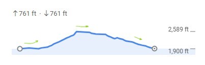
Total distance: 8 miles
Elevation: Max-Min difference 730 ft
This hike is intended for aspiring Pilgrims who are planning to participate in our 10-mile RU Ready hikes on March 20~23, or who simply want something a bit more challenging than our typical hikes. As always, please assess your hiking abilities as you consider doing this one.
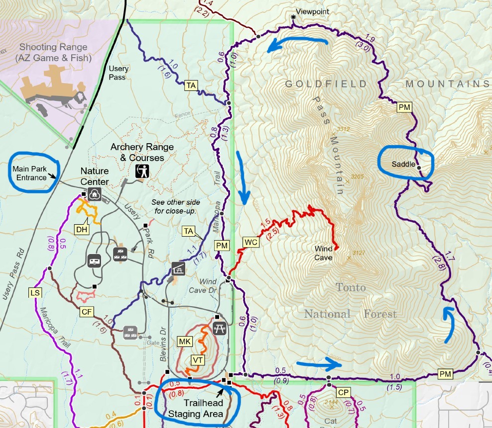
We will be hiking the Pass Mountain Trail which is a combination of packed gravel and a number of rocky stretches. We will go counterclockwise starting from the Staging Area. On the Usery Mountain Regional Park map this trail is rated ‘Difficult’ due to the combination of length, elevation and rockiness - hiking poles are recommended! There are no shortcuts to quickly return to the Staging Area; the only options are to backtrack on the trail, or keep going once we're past the halfway point.
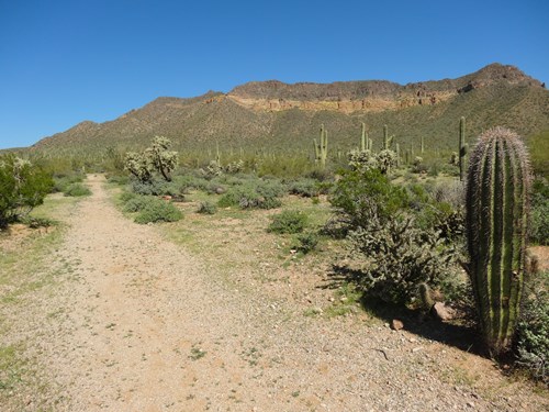
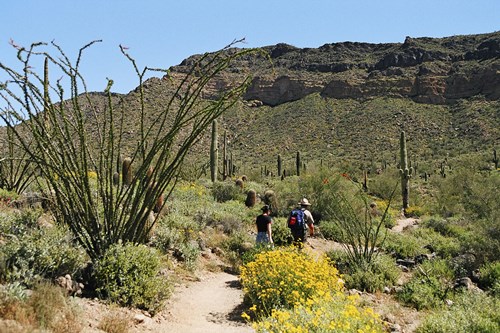
The Usery Mountain Regional Park is set at the western end of the Goldfield Mountains, adjacent to the Tonto National Forest. The park contains a large variety of plants and animals that call the lower Sonoran Desert home. The park is a great training ground for your Camino with Pass Mountain Trail or Wind Cave to add variety and elevation - although along the Camino Frances and Portuguese you won't encounter any of the rock step-ups found on these desert trails.
For park details and maps, see the official website here:
https://www.maricopacountyparks.net/assets/1/6/usery-8x14.pdf
Start at Trailhead staging area.
Go East on Pass Mtn Trail (purple track) for 1.5 miles.
Staying on PM Trail, turn North (left) towards the Saddle, 1.7 mi.
Continue on PM towards the Viewpoint in the North, 1.9 mi.
ATTENDEES
A total of 16 people have registered so far. The following 16 have opted to share their information.
No records found.
DETAILS

About Your Hike Leader
Steven has been an integral part of our chapter since its revitalization in 2021 and is now a Chapter Coordinator. He has walked the Camino Frances and the Camino Portuguese (from Lisbon) and served as a Hospitalero in 2024. He has lead many hikes in the McDowell Sonoran Preserve.
What to Bring
- $10 park entrance fee OR your Maricopa County Park Pass
- Your own map or navigation software of the area
- Water and snacks
- Hat and Sunscreen
- First aid kit
- Poles (recommended)
- A leave-no-trace toilet kit
- Cash for donations to support the chapter (optional)
Facilities
There are water and restrooms at the trailhead.
Guidelines
Please stay home if you are feeling sick.
Call or text your hike leader Steven @ 480-465-9732 on the day of the hike if you are unable to make it or are running late.
No dogs allowed due to chapter liability.
We will share the trail with other hikers and mountain bikers so despite our engaging conversations we will be aware of our surroundings and courteous by stepping off the trail or walking single file when necessary.
Reminders: Our chapter activities are led by volunteers. Donativo contributions (cash only) are greatly appreciated and are used to support future activities. Look for the orange donativo jar by the signup at the beginning of each hike.
We always gather in the spirit of the Camino. The hike leader will try to maintain awareness of the pace of the group, and will stop periodically at trail intersections to allow participants to catch up. However, hikers/walkers are differently abled and may not finish at the same time. If you want to hike ahead or stay behind and leave the group, please notify the hike leader or sweep. Please review the trail description before signing up to be sure the hike is right for you and your abilities. You participate at your own risk.
Directions
Visit https://azdot.gov/weekend-freeway-travel-advisory and plan your route and travel time accordingly.
Usery Mountain Regional Park: 3939 N. Usery Pass Rd, Mesa, is in North Mesa (near N. Ellsworth & E. McDowell Roads). Please use your car/phone navigation to find the best route on the day of the hike due to freeway construction.
To Staging Area - Follow Usery Park Road 1.5 miles through a few curves - DO NOT turn on Blevins Drive OR Wind Cave - until you see a LARGE GRAVEL parking area on your left with a space for a large RV and bathrooms.
PAY $10 Vehicle Entry Fee (or show Maricopa County annual pass)
Carpooling recommended, to save gas and fees. There are some big parking lots at Power and McDowell Roads if people want to meet up and carpool to Usery.